Targeting
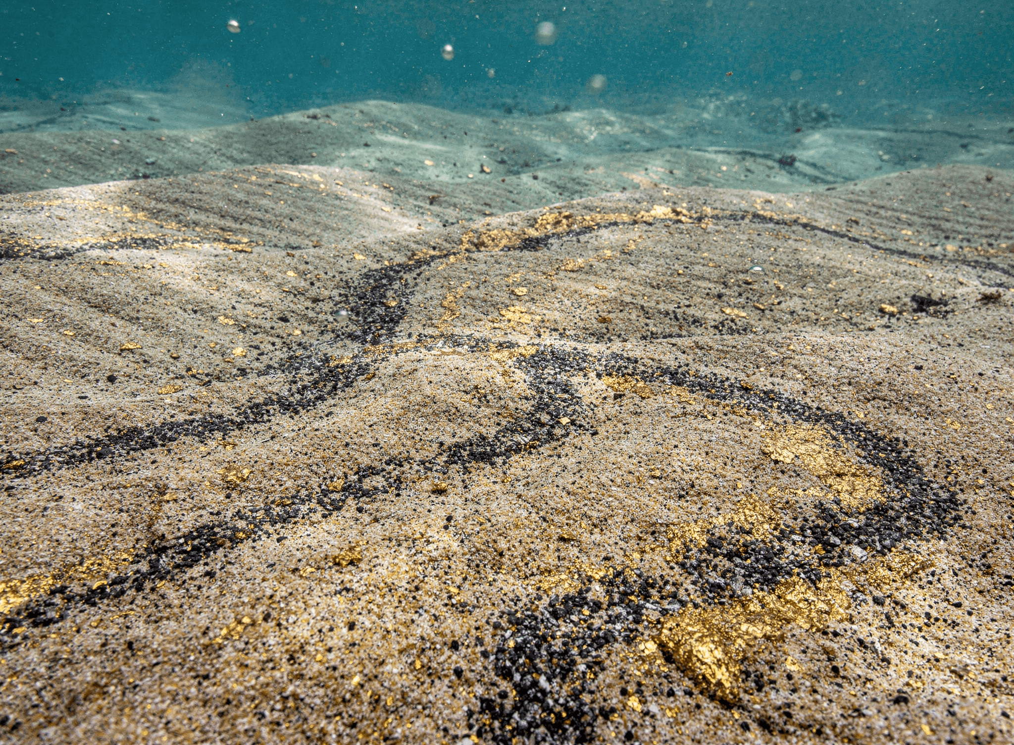
Gold-Bearing Aggregates
On Ghana's Shallow Continental Shelf
One of the Last Unexplored Gold Frontiers – in the World!
Only Place on Earth
Ghana — formerly known as the “Gold Coast” during British colonial rule — is the only place on Earth where such a rich concentration of gold mineralization is found so close to the coast.
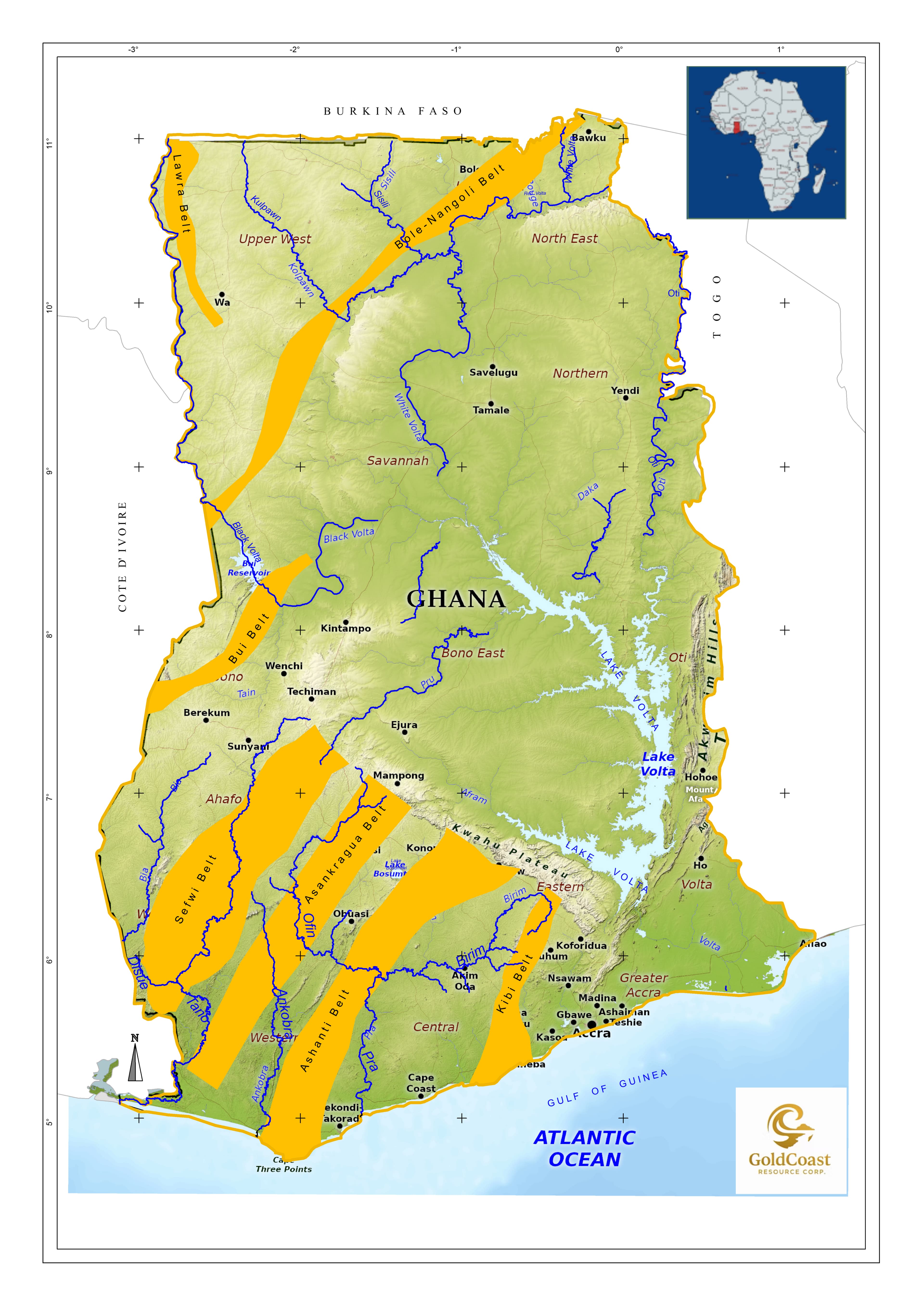
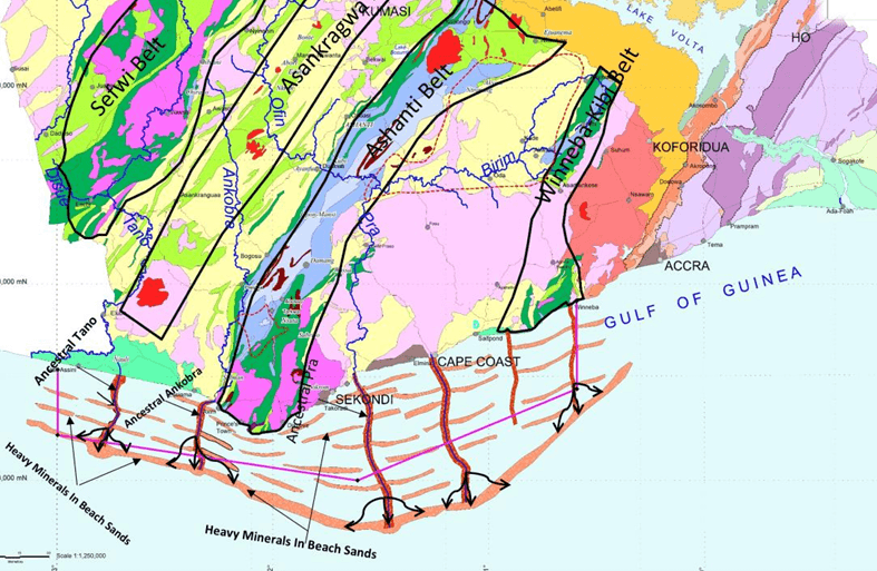
Three Rivers, World-Class Gold Districts
Importantly, this extensive gold endowment is mostly contained within 3 major river systems (the Tano, Ankobra & Pra) and their tributaries — that cut, band and drain these world class gold districts.
400 – 600 Vertical Meters of Gold-Bearing Alluvial Debris
Over vast millennial periods that preceded the Last Glacial Maximum (LGM) and the subsequent transition into the warming Holocene epoch, profound climatic and geological changes reshaped the West African coastline. During this time, global sea levels rose by more than 100 meters, Ghana’s coastline migrated approximately 30–50 kilometres inland to its present-day position, and high-energy river systems eroded enormous volumes of alluvial material — estimated at 400–600 vertical meters in places — transporting and depositing substantial quantities of accessory gold onto Ghana’s shallow continental shelf.
~200 Million Oz Estimated Eroded Inventory
GoldCoast Resource Corp. asserts that Ghana’s shallow continental shelf represents
— one of the last Unexplored Gold Frontiers — in the World!
“The amount of gold that has been weathered away
from the (SW) Ghana gold districts & carried to the Ocean
by major rivers would suggest eroded inventory is likely
in the order of ~200 million oz.”
Steeped in Logic & Science

Dr. Robert (Bob) J. Griffis, Ph.D.
Founder & Sr. VP Exploration
40 Year Resident of Ghana
Commissioned by the Minerals Commission of Ghana
Dr. Robert (Bob) J. Griffis, GoldCoast Resource Corp. Founder and Senior Vice President of Exploration, was commissioned by the Minerals Commission of Ghana in 1997 to undertake a comprehensive, systematic study of Ghana’s Gold Industry.
A 5-Year, 430-Page Authoritative Study
This study evolved over a period of 5 years, culminating in the publication of the highly regarded (438-page) textbook, entitled, “The Gold Deposits of Ghana.” (circa 2002)
View “The Gold Deposits of Ghana” →
Mandatory Reading Across the Industry
This authoritative body of work has gained considerable attention within the Mining Industry and is considered mandatory reading for those professionals working within the West Africa region, and beyond.
The Foundation of GoldCoast Resource Corp.
Over and above publishing a landmark textbook, Dr. Griffis’s deep dive into Ghana’s gold sector led to a theory with potentially far-reaching implications – that Ghana’s shallow continental shelf hosts significant untapped gold potential and may represent one of the world’s last unexplored gold frontiers.
GoldCoast Resource Corp. was founded with a singular purpose
— to pursue Dr. Griffis’ theory and validate its immense potential!
10 Contiguous Offshore Reconnaissance Licenses
10
Contiguous Licenses
~10,000km²
Licensed Area
~300km
Coastline Coverage
53%
Of Ghana's Total Coastline
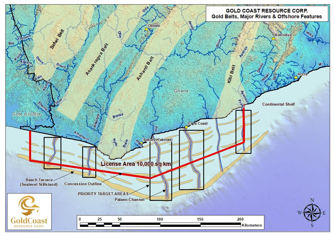
Ghana's onshore gold belts and major river drainages feeding GoldCoast's 10,000 km² offshore license area
Systematic Exploration
Charting Course to Resource Confirmation
Designed to progressively
de-risk the asset and build toward initiating production.
Utilizing Time Tested Proven Technologies That Have Evolved Over Centuries
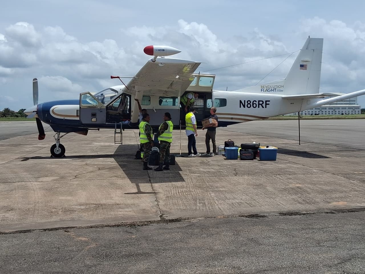
Phase IAirborne Survey
High-resolution aeromagnetic survey over the full 10,000 km² license area. Aircraft outfitted with high-sensitivity magnetometers flies systematic grid patterns at 50m altitude to detect magnetic anomalies associated with heavy mineral concentrations — gold pathfinders.
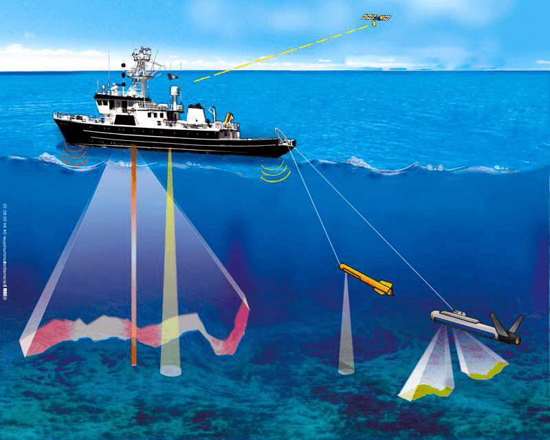
Phase IISeaborne Survey & Seafloor Mapping
Vessel-based multibeam sonar, echo sounders, sub-bottom seismic profiling, and GPS positioning to map the seafloor across the License area to generate a 3D bathymetric model of the seafloor. Identifies paleo-river channels, re-worked beach sand formations, and sediment trap geometries.
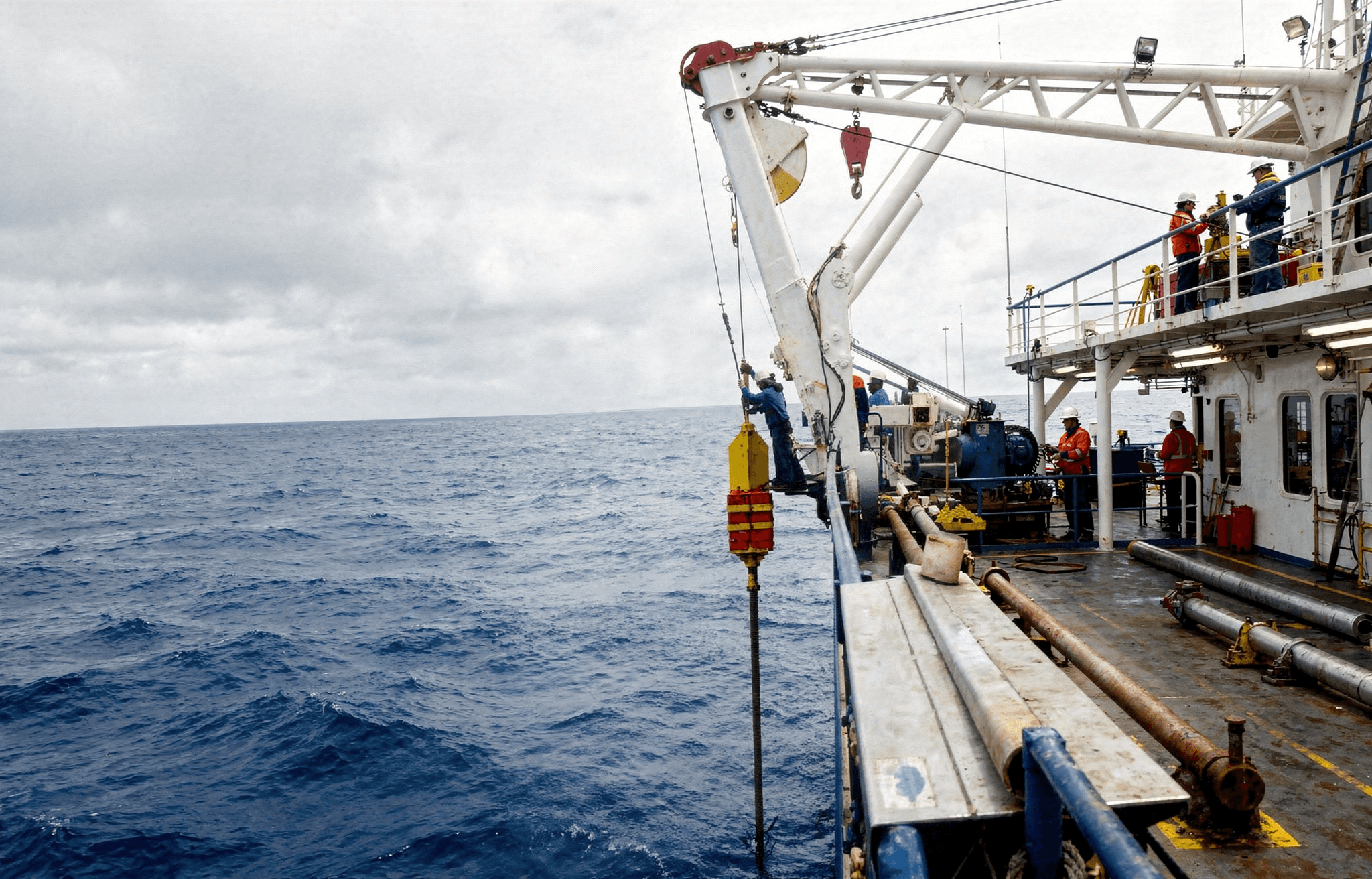
Phase IIISampling & Analysis
Systematic piston coring and grab sampling to recover stratified sediments from identified anomalies. Samples analyzed for heavy mineral concentrations including gold, ilmenite, and zircon. Results cataloged in a GPS-referenced GIS relational database for resource modeling.
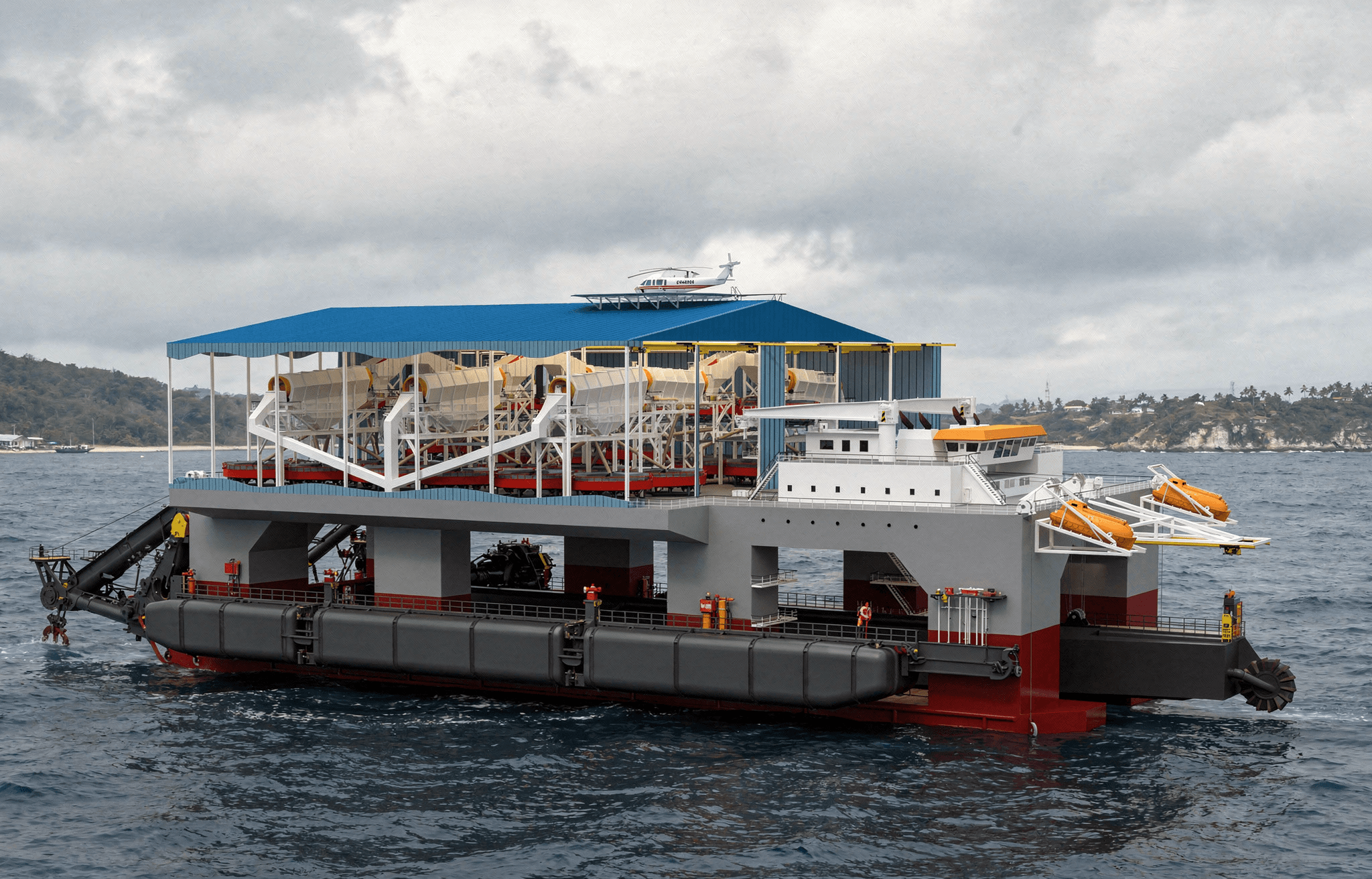
Phase IVBulk Sampling
Initiate near-shore shallow contract dredging operations. Target throughput of approximately 7.2 million m³ per year. Migrate from pilot testing to commercial production while continuing exploration across the license area.
Phase I — In Detail
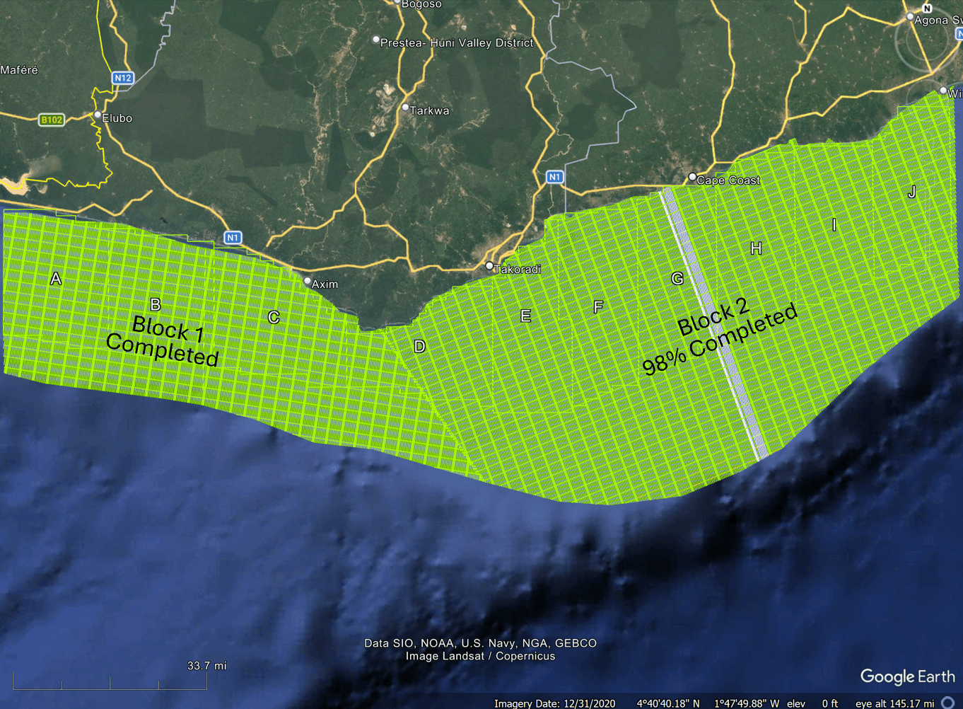
Progress as of June 18, 2026 — tie lines to be flown once primary lines are complete
43,708
Total line kilometers flown to date
45,361
Total line kilometers in the survey plan
100%
Coverage of Block 1 — complete
98%
Coverage of Block 2
70
Total sorties flown to date
Airborne
High-Resolution Aeromagnetic Survey
Paleo-Channel & Paleo-Beach Sands Targets — Geology Only
The Earth’s Main Field (IGRF Correction)
A massive background field modeled and completely removed.
Total Magnetic Intensity (TMI) & Total Horizontal Gradient (THG)
All plane movements, solar shifts, and altitude errors are mathematically stripped away and all data leveled.
Reduced to Pole (RTP)
Recalculates data as if recorded at the North Pole, shifting magnetic bodies directly over the actual physical locations.
Placer Gold Targeting
Utilizes a final dataset to apply filters, derivatives, integration and interpretation of placer gold geometry traps.
Phase II — In Detail
Seaborne
Seismic, Bathymetry & Magnetometry Surveys
Survey Scope
Simultaneously deploy multibeam sonar, seismic echo sounders, and GPS positioning to map the seafloor across the License area at high resolution.
Objective
Generate a 3D bathymetric model of the seafloor within Areas of Interest — identify and map paleo-river channels and re-worked beach sand formations, sediment traps, and geological structures.
Seismic Survey Methodology
Seismic survey provides geological information on the various layers to define paleo gravels for up to 50 meters below ocean floor.
Bathymetric Methodology
Vessel-based survey using multibeam echo sounders and motion sensors. Data collected includes depth, slope, sediment morphology, wave/tidal interactions.
Magnetometry Integration
Conducted concurrently with bathymetry using marine magnetometer towed arrays. Designed to delineate high-res magnetic anomalies (initially detected by Airborne Mag Survey) indicative of heavy mineral presence — Gold Pathfinder.
Priority Seaborne Targets
Mapping Paleo River Channels for Placer Gold
Last Glacial Max
~20,000 years ago; sea levels were ~100m lower; Ghana’s emerged coastline 30 – 50 km further out to sea.
400 – 600 Vertical Meters
of oxidized, gold-bearing bedrock in SW Ghana has been eroded and carried to the ocean, much of this during the Last Glacial Maximum and particularly during the transition into the warming Holocene epoch.
Low Sea Levels
result in eroded gold bedload concentrated in emerged ancient paleo river channels and beach sands.
Rising Seas
in the Holocene (~11,500 years ago) flooded ancient channels, rapidly burying gold-rich sediments.
High-Energy Rivers
reworked and concentrated gold into submerged channels and “trap geometries” — low points and depressions — forming shelf deposits and re-worked beach sands redistributed by strong longshore currents.
High-Priority Targets
offshore zones where multiple world-class gold belts are cut and drained by 3 major river systems — and tributaries — that flow onto the ocean’s shallow continental shelf.
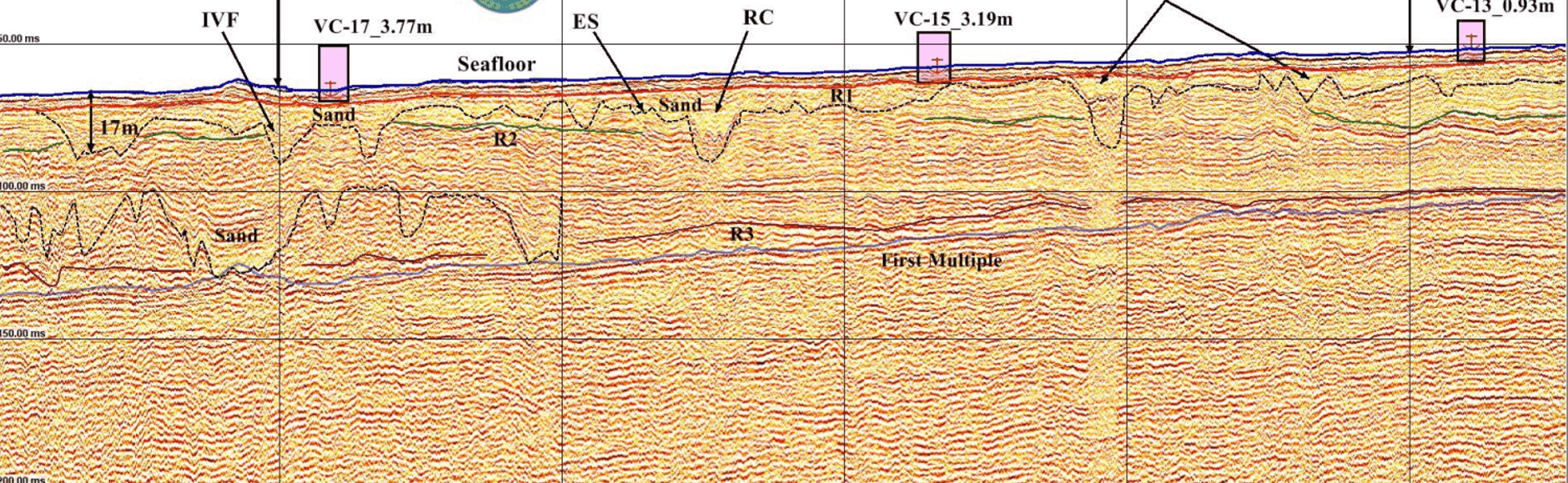
Sub-Surface Imaging
Shallow Seismic Sparker & Sub-Bottom Profiler
The system transmits sound waves toward the seafloor from both sides of the towfish, then records intensity of the reflected signal.
As the vessel moves along a trackline, an acoustic “picture” of a swath of seafloor is generated.
Hard areas such as rock produce stronger reflections, while softer material such as smooth sand or silt will generate weaker reflections.
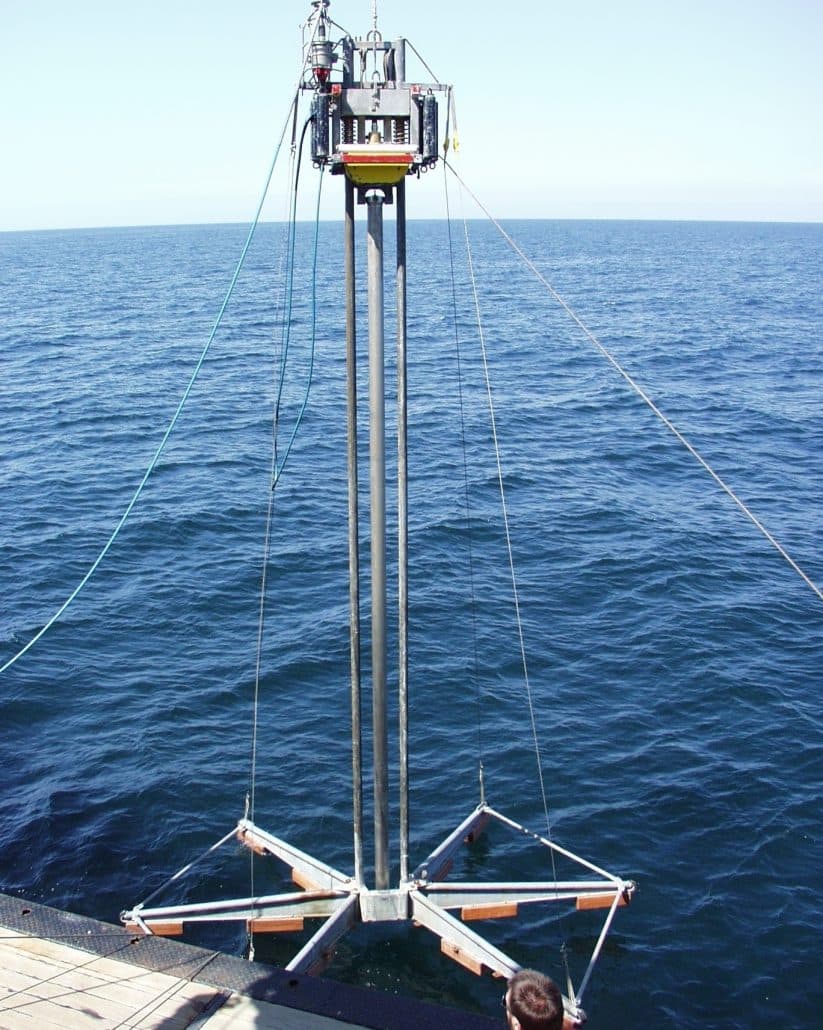
Sediment Sampling
Vibro Core Sampling Equipment
Vibro Core Drill
Specialized, high-frequency, low-amplitude vibrating drill. Used to collect undisturbed, continuous samples of unconsolidated offshore sediments.
Core Barrel
A thin-walled tube, often aluminum or stainless steel, that houses a clear PVC or plastic liner to hold the sediment sample.
Shallow Water Offshore
Mineral Extraction Is Proven
GoldCoast is not inventing a new category. The technology and operating models for offshore mineral recovery have been established for decades.
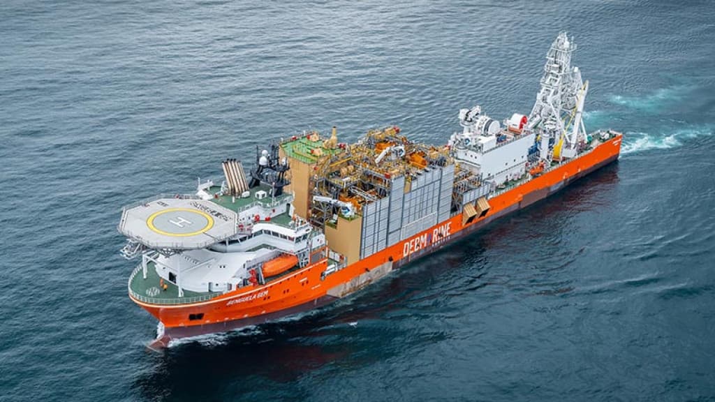
Debmarine Namibia
20+ years of offshore recovery
A joint venture between De Beers and the Government of Namibia has been recovering diamonds from the seafloor off Namibia's coast for over two decades using advanced marine mining vessels. Debmarine accounts for a significant portion of Namibia's total diamond production.
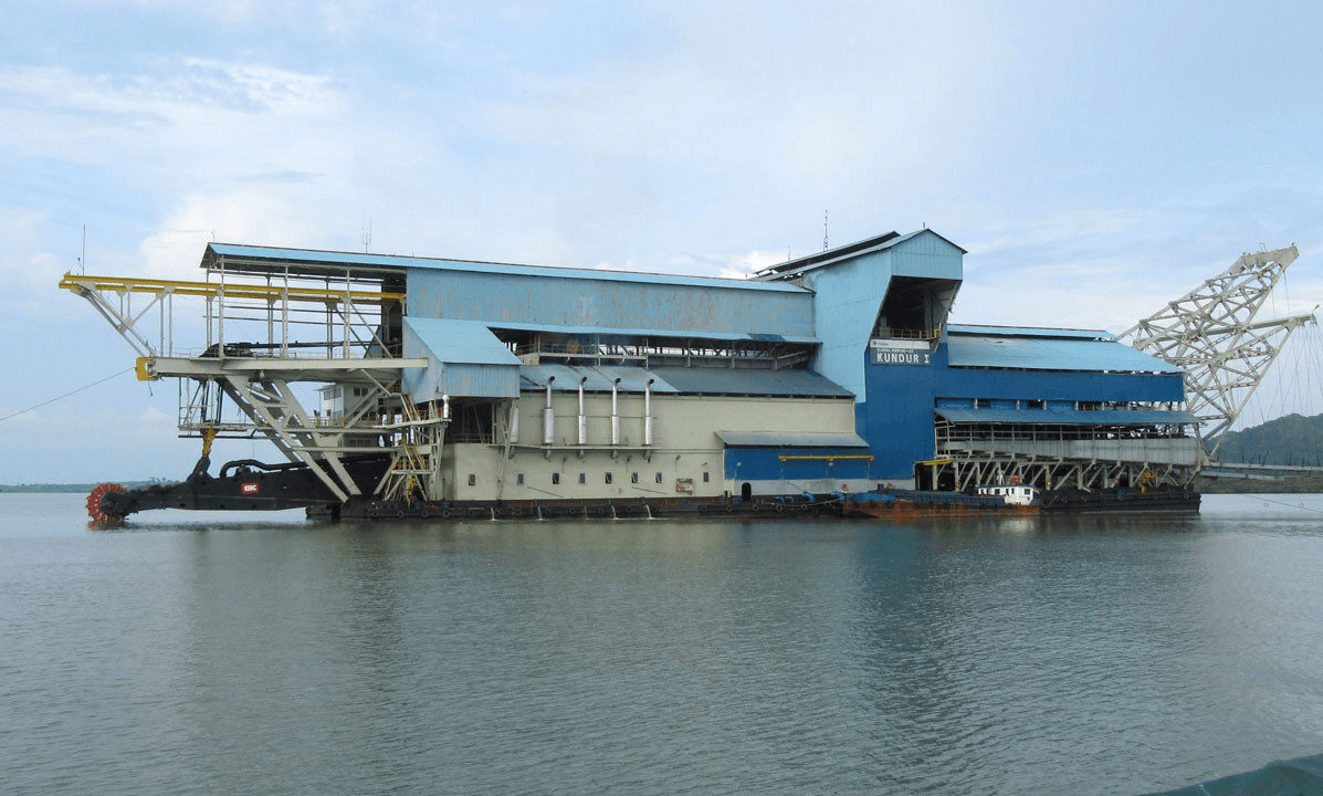
PT Timah
100+ years of offshore dredging
Indonesia's state-owned tin mining company has operated offshore dredging operations in the Bangka-Belitung islands for over a century. PT Timah is one of the world's largest integrated tin miners, with a fleet of dredges and suction vessels operating in shallow waters.
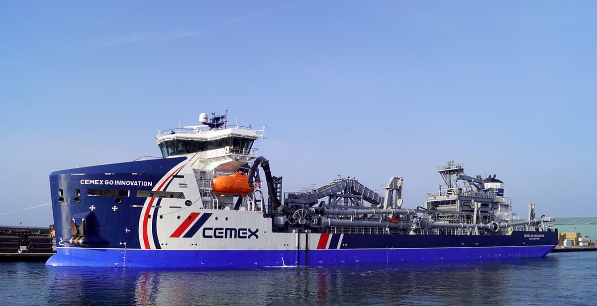
The Crown Estate (UK)
50+ years of marine extraction
The UK has maintained a mature offshore aggregate extraction industry for over half a century, with the Crown Estate licensing large areas of seabed. The industry supplies roughly 20% of England's sand and gravel needs from the marine environment.